

Nghe Cape Da Nang, or Mui Nghe, sits on the remote eastern side of Son Tra Peninsula. Its rocky coastline, open sea views, and natural rock basin have made it increasingly popular in photos and travel videos.
Nghe Cape is not a normal Da Nang attraction with a paved road, parking area, marked trail, or visitor facilities. Reaching the coastline involves difficult terrain and exposed rocks, while the sea can change quickly.
More importantly, Nghe Cape is currently outside the authorized sightseeing routes on Son Tra Peninsula. That is the first thing I think visitors should know before adding Mui Nghe to a Da Nang itinerary.
Son Tra is a large protected natural area covering around 4,400 hectares, with forested slopes, steep coastline, and sensitive wildlife habitats. Nghe Cape lies near the far eastern edge of the peninsula, which explains both its scenery and why access is very different from established places such as Linh Ung Pagoda or Ban Co Peak.
This Triplory guide focuses on the practical questions travelers actually need answered: Can you visit Nghe Cape now? Why is access restricted? How dangerous is the area? What happened in August 2026? And where can you go instead?
Access rules on Son Tra can change, so check the latest official information before visiting any remote part of the peninsula.
Nghe Cape at a Glance
Last updated: August 31, 2026
| Visitor Information | Current Details |
|---|---|
| Vietnamese name | Mũi Nghê |
| English name | Nghe Cape |
| Location | Eastern side of Son Tra Peninsula, Da Nang |
| Distance from central Da Nang | Approximately 15 km northeast |
| Current access status | Not an authorized tourist route |
| Official trekking trail | No |
| Tourism facilities | None |
| Lifeguards | None |
| Swimming conditions | Unmanaged and potentially dangerous |
| Should you visit now? | No, unless access is officially authorized in the future |
The main point is simple: Nghe Cape may appear on maps, blogs, and social media, but that does not mean visitors are officially allowed to reach it.
Can Tourists Visit Nghe Cape?
Current Access Status
At the moment, Nghe Cape is not part of the authorized visitor routes on Son Tra Peninsula.
The same applies to other remote coastal areas such as Huc Lo and Bai Da Den.
These areas are controlled because of safety concerns, forest protection, and the sensitive nature of parts of Son Tra Peninsula.
Visitors approaching restricted sections may encounter barriers, warning signs, checkpoints, forest rangers, or border guard personnel.
If a road or trail is closed, treat that as the end of the route.
Unauthorized entry into protected forest or conservation areas can also lead to administrative penalties under Vietnamese forestry and environmental regulations.
Why Old Guides Can Be Misleading
This is one reason Nghe Cape can be confusing to research.
There are still old blogs, YouTube videos, map routes, and social posts showing people trekking down to the cape.
Some were created before access restrictions were strengthened and additional barriers were installed in the second half of 2026.
Those pages do not disappear when the rules change.
A trail shown on Google Maps may be old, unofficial, closed, or no longer maintained. A recently uploaded photo also does not prove that the route is legally open.
Even a tour advertisement should not automatically be treated as official permission.
For that reason, Triplory does not publish step-by-step directions to the restricted route at Nghe Cape.
If the area officially reopens later, this guide can be updated with the permitted route and conditions.
Where Is Nghe Cape?
Nghe Cape is located on the far eastern side of Son Tra Peninsula, around 15 km northeast of central Da Nang.
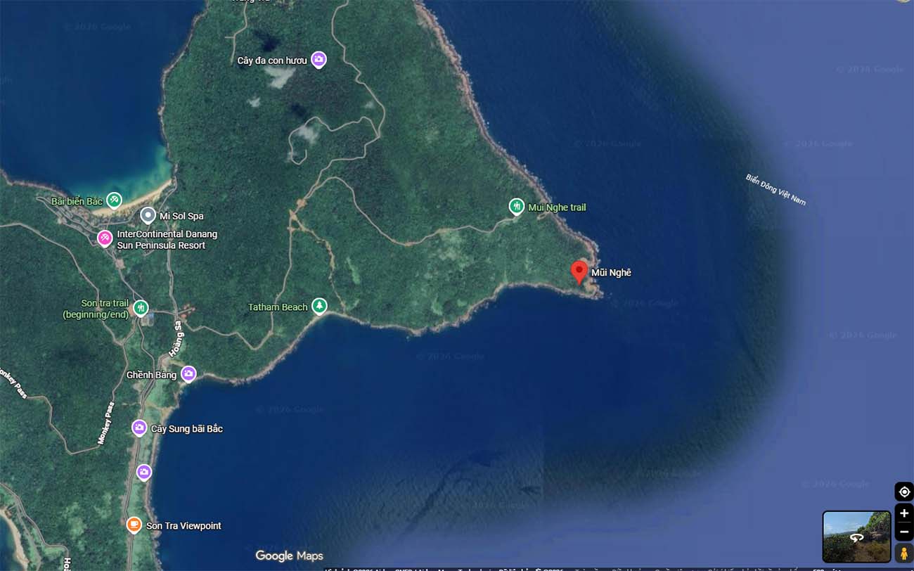
It faces the open sea and sits in a much more remote part of Son Tra than the areas most visitors normally explore.
Son Tra itself has an interesting geological history. Millions of years ago, the area was an offshore island made up of three mountain peaks. Over time, sand and sediment carried by the Han River formed a connection with the mainland, creating the peninsula we see today.
Nghe Cape lies near the eastern end of that formation.
The contrast across Son Tra is quite noticeable.
On the southern and western sides, visitors have paved roads and established attractions such as Linh Ung Pagoda.
Farther east, the landscape becomes more isolated, with forested slopes falling toward a rocky coastline and very little tourism infrastructure.
There are no paved tourist roads or normal visitor facilities at Nghe Cape itself.
Understanding the Area on a Map
If you want to understand where Nghe Cape sits, use the official Son Tra attractions as your reference points rather than following old trail lines.
From Da Nang, Vo Nguyen Giap Street and Hoang Sa Road lead north toward Son Tra Peninsula.
Established places include:
- Linh Ung Pagoda and the Lady Buddha on the southern side
- Ban Co Peak via the controlled mountain road network
- Son Tra Heritage Banyan Tree farther east along the designated visitor area
Nghe Cape lies beyond these better-developed sightseeing zones.
Seeing it marked farther along the coastline does not mean there is an official public road connecting to it.
Why Has Nghe Cape Become Popular?
The answer is fairly straightforward: Nghe Cape looks impressive in photographs. Its rocks, forested backdrop, open sea, sunrise views, and natural seawater basin have made it particularly attractive to photographers and social-media users.
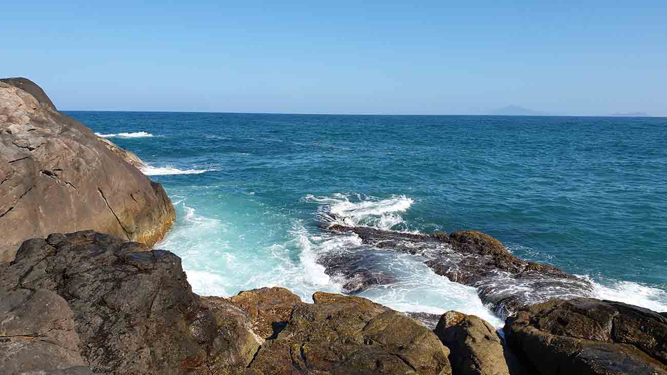
Dramatic Coastal Scenery
The landscape looks very different from Da Nang’s developed beachfront.
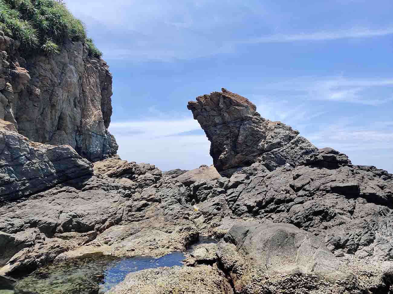
Dark, uneven rocks meet the open sea, while the forested slopes of Son Tra rise directly behind them.
The name Mũi Nghê is commonly associated with a rock formation said to resemble the head of a mythical nghê or, from another angle, an elephant’s trunk reaching into the water.
Before access became restricted, the cape was also well known for sunrise photography because of its eastern position.
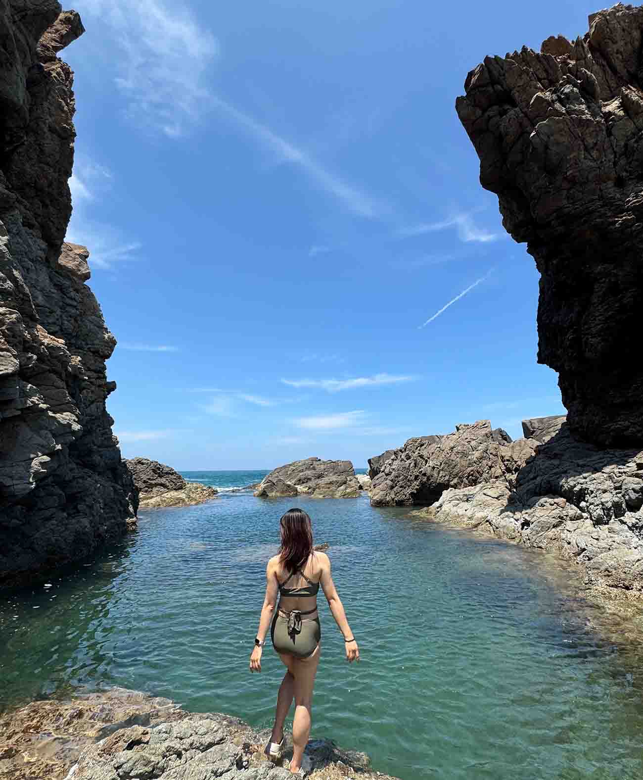
The Natural Seawater Pool
A natural depression in the rocks fills with seawater as the tide moves in and out. During calm conditions and low tide, photographs can make it look like a small natural swimming pool.
It is sometimes described online as an “infinity pool.”
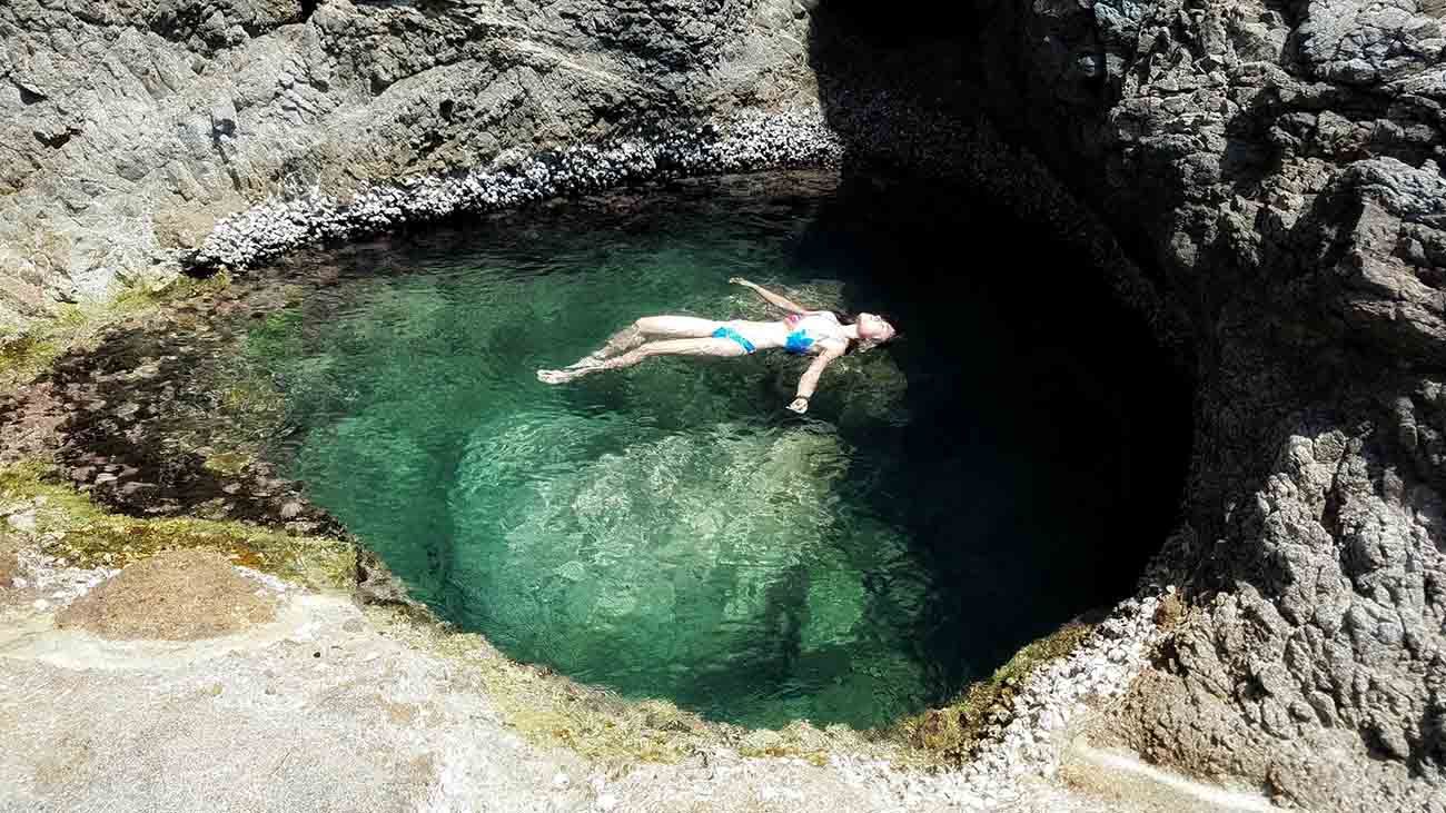
There are no lifeguards, controlled water levels, or protective barriers between the rock basin and the open sea. Waves, currents, tides, and sudden swells still affect the water inside.
Something that looks calm in one photograph may be very different half an hour later.
Social Media Shows Only Part of the Story
Photos and drone footage helped make Nghe Cape famous, but they also make the place look easier to reach than it really is.
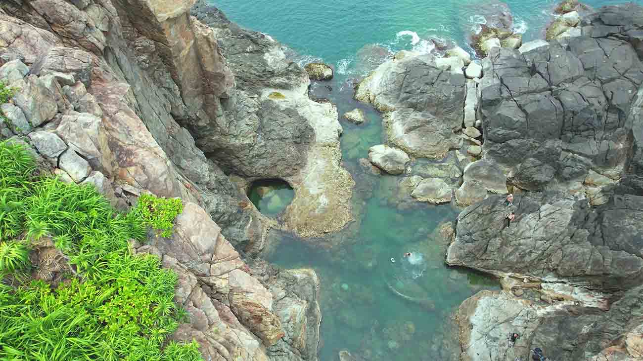
A cropped photograph does not show the steep forest terrain behind the camera.
It does not show the lack of a maintained trail, the sharp rocks, changing waves, or current access restrictions.
That is why I would use social media to understand what the place looks like, not to decide whether it is safe or legal to visit.
Why Is Trekking to Nghe Cape Dangerous?
Several risks come together at Nghe Cape: difficult terrain, an exposed coastline, no normal visitor infrastructure, and difficult emergency access.
Steep and Unmaintained Terrain
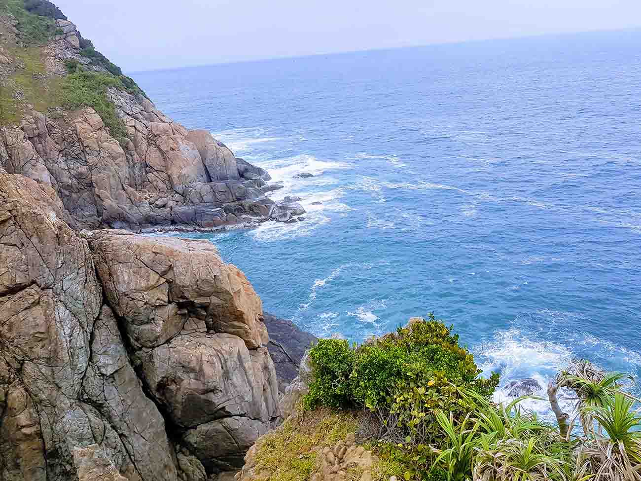
There is no maintained tourist trail leading to the cape.
The descent uses narrow forest paths with loose rocks, exposed roots, and unstable soil. There are no handrails, distance markers, or normal directional signs.
Rain makes the situation worse.
Wet soil, roots, and rocks become slippery, increasing the risk of falls and injuries.
A sprained ankle that would be inconvenient at a normal attraction can become a much more serious problem when you are far from a road.
Unpredictable Waves and Currents
Nghe Cape faces the open sea.
Waves and swells can reach the rocks with little warning, even when the water appears fairly calm from above.
Tides, offshore weather, and currents can also change the conditions quickly.
The natural seawater basin is affected by the same sea.
A sudden wave can enter the basin or wash across nearby rocks, which is why I would not treat it as a normal swimming spot.
No Visitor Infrastructure
Nghe Cape has:
- No maintained tourist trail
- No lifeguards
- No official swimming zone
- No warning-flag system
- No drinking-water facilities
- No toilets
- No shelters
That matters more than it may sound.
Heat, dehydration, or a relatively small injury becomes harder to deal with when there is nowhere nearby to rest or ask for help.
Emergency Rescue Is Difficult
Land access is limited, and moving an injured person back up a steep forest slope may require a specialized rescue team.
Approaching from the sea is also difficult because of rocks, submerged reefs, and waves.
Rescue services therefore cannot reach Nghe Cape as easily as they can reach a managed beach or roadside attraction.
What Happened at Nghe Cape in August 2026?
A serious accident on August 8, 2026 showed why these risks should not be treated lightly.
At around 6:00 AM, a group of six young visitors reached the rocky shoreline using an unauthorized route. They had reportedly gone there to take photographs and swim.
While the group was on the exposed rocks, large waves swept four people into the sea: three 24-year-old women and one 30-year-old man.
The Rescue Operation
Da Nang authorities launched a search-and-rescue operation involving the Son Tra Border Guard Station, local fishing vessels, and SAR 274 from the Maritime Search and Rescue Coordination Center Region II.
The 30-year-old man was rescued by a fishing boat shortly after the accident.
Later that afternoon, another member of the group was found after spending roughly eight hours at sea using a makeshift float. She was located around two nautical miles offshore.
Search operations continued for the remaining two women and expanded offshore toward Cu Lao Cham.
According to the official update referenced for this guide, the search was formally concluded on August 16, 2026, without locating them.
I am including this incident because it gives useful context to the restrictions.
It is not just a theoretical warning about rough terrain. An accident in this location can become a major rescue operation very quickly.
Following the incident, authorities reinforced warnings, barriers, and patrols around unauthorized access areas.
Can You Reach Nghe Cape by Boat or SUP?
Using the sea does not automatically solve the access problem.
A boat, kayak, basket boat, or SUP introduces a different set of risks, while the legal status of the area still applies.
There Is No Proper Landing Area
Nghe Cape has no tourist pier, pontoon, or managed landing point.
The shoreline is rocky, with submerged reefs and direct exposure to open-water waves.
Even a motorized boat may have difficulty approaching safely.
Small Watercraft Are More Exposed
Kayaks, basket boats, and stand-up paddleboards (SUPs) sit much closer to the water and are more affected by swell and changing sea conditions.
A wave can overturn or push a small craft toward the rocks.
That is especially concerning in an area without lifeguards or an established rescue station.
Before Booking Any Boat Trip
If an operator claims to offer Nghe Cape access, ask them to confirm:
- Legal authorization for that specific tourism route
- Licensed vessel documentation
- Passenger insurance covering maritime accidents
- Appropriate life jackets and communication equipment
- A clear weather cancellation policy
- Official permission to enter or land in the area
If they cannot clearly show that the trip is authorized, I would not book it.
For now, Triplory does not recommend unofficial access by boat, fishing vessel, kayak, basket boat, or SUP.
The sea should not be treated as a workaround for restrictions on land.
Safer Alternatives to Nghe Cape
You do not need to reach Nghe Cape to get coastal views, forest scenery, or a good Da Nang sunrise.
There are easier and officially managed alternatives.
| Alternative | Best For | Access | Main Consideration |
|---|---|---|---|
| Linh Ung Pagoda & Lady Buddha | Coastal views and culture | Paved road and established visitor area | Dress respectfully; can be busy |
| Ban Co Peak | Mountain and city views | Controlled Son Tra route | Check vehicle and weather restrictions |
| Son Tra Heritage Banyan Tree | Forest scenery | Designated route | Check current access hours |
| My Khe Beach | Swimming and sunrise | Managed public beach | Follow warning flags |
| Man Thai Beach | Sunrise and local coastal atmosphere | Public beach area | Fishing activity in the morning |
I would not list Ghenh Bang, Huc Lo, or Bai Da Den as safer alternatives because they are also subject to restrictions and unmanaged coastal conditions.
Linh Ung Pagoda and Lady Buddha
If the sea view is what interests you most, Linh Ung Pagoda is the obvious alternative.
The complex sits above the coastline and includes the 67-meter Lady Buddha statue, with wide views across Da Nang Bay and the East Sea.
There is paved access, parking, gardens, and established walkways.
Because it is an active religious site, wear clothing that covers your shoulders and knees.
Ban Co Peak
At nearly 700 meters above sea level, Ban Co Peak gives you a higher view over Da Nang, the coastline, and the distant Marble Mountains.
The road is controlled and can be affected by vehicle restrictions and weather.
Under the rules used for this guide, automatic scooters are not permitted on the ascent, while manual and semi-automatic motorbikes may be allowed.
Rain, fog, or poor road conditions can also lead to temporary closures.
Check at the checkpoint before going up.
Son Tra Heritage Banyan Tree
For forest scenery, the Son Tra Heritage Banyan Tree is a better choice than trying to enter an unofficial trail.
The tree is known for its large network of aerial roots and lies within a designated visitor area.
Follow the access hours and conservation rules while visiting.
My Khe or Man Thai Beach at Sunrise
If sunrise is the main reason you were considering Nghe Cape, My Khe Beach and Man Thai Beach are much more practical.
Both face east and give you open views toward the morning sun without requiring a forest trek.
Choose My Khe if you also want a managed swimming beach.
Choose Man Thai if you are more interested in the local fishing atmosphere early in the morning.
Whichever beach you choose, still pay attention to warning flags and sea conditions.
Official Routes on Son Tra Peninsula
Son Tra is best explored using the officially managed routes.
These roads are controlled for road safety, forest conservation, landslide risk, and sensitive areas within the peninsula.
Hoang Sa Road to the Heritage Banyan Tree
This route follows the lower eastern side of Son Tra toward the Heritage Banyan Tree.
Visitors may pass through a checkpoint where entry is recorded and visitor identification is issued.
Manual and semi-automatic motorbikes are generally permitted along most of the route.
Under the access conditions used for this guide, the final section from the Bai Bac intersection to the Banyan Tree is restricted to pedestrians.
Treat the Banyan Tree area as the end of the visitor route rather than continuing into the forest toward Nghe Cape.
Yet Kieu Road to Ban Co Peak and Bai Bac
This is the steeper mountain route.
The section from Ban Co Peak toward Bai Bac operates as a one-way road to reduce the risk of vehicles meeting on narrow bends.
Under the rules used for this guide, the following may be restricted:
- Automatic scooters
- Bicycles
- Passenger vehicles with more than 24 seats
Heavy rain, fog, or strong winds can also close the route because of poor visibility and landslide risk.
Yet Kieu Road to Suoi Om
The Yet Kieu – Suoi Om route provides controlled access to the interior forest areas.
During the dry season from March to September, general visiting hours used in this guide are:
7:30 AM – 6:30 PM
During the rainy season from October to February:
7:30 AM – 5:30 PM
Stay on the designated route because surrounding forest areas include sensitive wildlife habitat and national defense zones.
Access Can Change
Roads may close because of:
- Heavy rain
- Fog
- Strong winds
- Landslides
- High forest-fire risk
- Military activity
- Emergency road conditions
Check current conditions before riding into Son Tra, especially if Ban Co Peak or the Heritage Banyan Tree is part of your plan.
Practical Tips for Visiting Son Tra Peninsula
Check Access Before You Go
Son Tra is not a place where I would rely entirely on an old map screenshot.
Check recent information from Da Nang tourism authorities and ask at the official checkpoint if you are unsure about a road.
If a road is temporarily closed, change the plan rather than looking for a way around it.
Use a Suitable Vehicle
Different roads have different vehicle restrictions.
Check what your route allows before renting a motorbike.
Some of the steeper roads may restrict automatic scooters because long descents require more effective engine braking.
Wear a proper helmet and avoid high mountain roads during heavy rain, fog, or strong winds.
Watch the Time
Son Tra has controlled visiting hours.
For the schedule used in this guide:
- March – September: generally until 6:30 PM
- October – February: generally until 5:30 PM
Leave enough time to return before the checkpoint closes.
Respect the Wildlife
Son Tra supports nearly 1,000 plant species and important populations of the endangered red-shanked douc langur.
A few things should be obvious, but they are still worth saying:
- Do not feed wildlife
- Do not chase animals for photos
- Stay on designated roads and trails
- Take rubbish back out with you
- Do not light fires
- Follow restrictions on drones and commercial filming
Feeding monkeys or langurs can change their natural behavior and is not a harmless photo opportunity.
Prepare for Changing Weather
Weather can shift quickly around the peninsula, particularly from September through November.
Check rain, wind, and sea conditions before leaving.
Take drinking water, especially if you are heading toward the higher sections where shops are limited.
If local authorities issue a severe-weather warning, choose another activity for the day.
Emergency Numbers
Keep these numbers saved:
- 112 – National search and rescue
- 115 – Medical ambulance
- *8899 – Emergency dispatch service intended to assist English-speaking foreign visitors in major Vietnamese cities
Hopefully you will never use them, but having the numbers beforehand is easier than searching during an emergency.
How to Verify Whether Nghe Cape Has Reopened
Access may change in the future.
If you see a recent post claiming that Nghe Cape has reopened, check the official status before changing your itinerary.
Ask:
- Has Nghe Cape officially been added to an authorized visitor route?
- What type of access is permitted?
- What are the visiting hours?
- Is trekking allowed?
- Is swimming allowed?
- Is boat access or landing permitted?
These are separate questions.
A viewpoint reopening does not necessarily mean visitors are allowed to swim or continue beyond it.
I would also not treat any of the following as proof that the area has reopened:
- A barrier has disappeared
- Other tourists are going through
- A recent Google Maps review says it is open
- A TikTok or YouTube video shows someone there
- A tour is advertised without clear official authorization
Wait for confirmation from the relevant local authority.
If the rules change, Triplory can update this guide with the new access conditions.
Final Thoughts: Should You Visit Nghe Cape?
It is easy to see why travelers are interested in Nghe Cape.
The coastline looks very different from the developed beaches of Da Nang, and the photos are impressive.
But under the current restrictions, I would not recommend trekking, swimming, or using an unofficial boat or SUP route to reach it.
For me, the decision is quite simple.
If a place is not officially open and an accident there is difficult to respond to, I do not think one photograph or sunrise is worth trying to get around the rules.
You still have plenty of good options around Son Tra.
Go to Linh Ung Pagoda for coastal views, Ban Co Peak for elevation, the Heritage Banyan Tree for forest scenery, or My Khe and Man Thai for sunrise.
Those places give you much of what draws people to Nghe Cape without turning the day into a question of whether you are somewhere you should not be.
Access update — August 2026: Nghe Cape, Huc Lo, and Bai Da Den remain outside the authorized visitor routes covered in this guide. Triplory will update this section if official access regulations change.
For more detailed planning, see Triplory’s guides to Son Tra Peninsula, Linh Ung Pagoda, My Khe Beach, and other Da Nang attractions.